
Gaussian splatting capture tools in 2026: phones, cameras, 360, LiDAR, drones
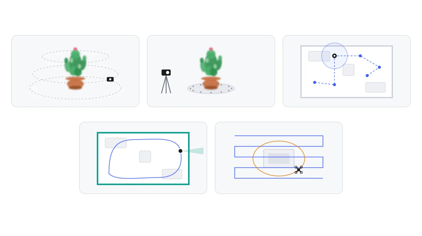
Every Gaussian splat starts with images. Who takes them, and with what, decides most of what follows: the quality, the time spent on site, and whether the result has a true scale. In September 2026, five families of tools do the job — a phone, a camera, a 360 camera, a handheld LiDAR scanner, a drone — and all of them now produce splats, sometimes directly.
This article is the buyer’s guide: how each family is used, what it costs, and which fits which project. The deeper question of what each method guarantees — photogrammetry that estimates, LiDAR that measures — is the subject of our article iPhone, 360 camera or LiDAR: what your capture guarantees. What happens to the images next is in the production workflow.
How you move with each tool
Phone or camera — Rings around the subject
- Three rings or more, from low to high, so the top and the underside are seen too.
- A photo every 15 to 20 degrees on each ring — 18 to 24 per ring — with 70 to 80% overlap between neighbours.
- Settings locked from start to finish: exposure, white balance, focus.
Camera on a tripod — The turntable
- The subject turns; the camera and the lights stay still. The background must therefore be plain and even — or masked — or the software thinks the whole room is turning.
- A shot every 15 degrees, about 24 per turn, then raise or tilt the camera for the next ring.
- Turn the object over for its underside, then merge the two captures.
360 camera — Stops through a room
- Each stop — or each frame of a slow video — records the whole sphere at once.
- Keep the stops close, so that each view shares much of the previous one; add more around corners and doorways.
- Hold the camera above your head or on a pole: you appear in every image unless the software masks you.
Handheld LiDAR scanner — A closed loop
- Walk through the whole space at a steady pace: the scanner tracks its own position as it goes.
- Close the loop — come back to where you started — so the software can correct the drift.
- Colour comes from the scanner’s cameras: the light still matters.
Drone — Passes, then an orbit
- Parallel passes looking down cover the ground and the roofs; an orbit with the camera tilted captures the façades.
- Add shots from the ground for the lower floors, which the drone sees badly.
- In France, a registered operator and the right category: flying in public space in a built-up area is not allowed in the open category.
Five ways of capturing, each with an animated drawing and the rules that make it work: rings around an object, a turntable, stops through a room with a 360 camera, a closed loop with a LiDAR scanner, passes and orbits with a drone.
Five tools, five ways of moving. The rules for rings and turntables follow PlayCanvas’s capture guide; the others, the manufacturers’ guides and our own practice.
The phone: the easiest start
A recent phone and a free app are enough for a first splat, and increasingly for a good one. Scaniverse, by Niantic Spatial, trains the splat on the phone itself, offline, in about ninety seconds; since its 29 September update it also accepts 360 video, on paid plans. Polycam and KIRI Engine process in the cloud, with limits on the number of photos that depend on the plan (150 on Polycam’s free plan, 2,000 on its business plans). XGRIDS’ new LCC Scan app, in beta since September, trains a splat on an iPhone in about two minutes.
Do you need LiDAR? For a splat, no: the phone’s camera does the work. Apple’s LiDAR sensor, on every Pro iPhone since the 12 Pro and on the iPhone 18 Pro, mainly helps with scale and with meshes. Android phones have no equivalent. Note that Epic’s RealityScan Mobile, free, produces textured meshes, not splats.
The limits are those of your arm and your patience: a phone suits objects and small spaces, not a façade or a site.
The camera: the best images, at a price in time
For a product, an artwork or any object where quality comes first, a mirrorless or reflex camera still gives the best images: RAW files, a sharp lens, exposure under control. The guides converge: 120 to 140 images for a contained subject, up to around 600 for a large open scene, at least 60% overlap between neighbours, from three heights, at f/8 to f/11 and a shutter speed fast enough to rule out any blur (Radiance Fields).
For repeated work on small objects, a turntable saves time: the object turns, the camera stays on its tripod, and a light tent evens out the light. The background must then be plain, or masked — otherwise the software thinks the whole room is turning around the object.
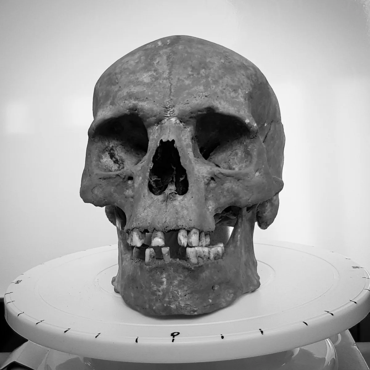
A turntable graduated around its edge, the simplest way to photograph an object from every angle at regular intervals — here a skull being prepared for a 3D scan.
Image: Watty62, CC BY-SA 4.0, via Wikimedia Commons (resized, converted to WebP).At the other extreme, studios use cages of synchronised cameras, such as ESPER’s LightCage, which takes up to 150 cameras and captures every viewpoint in an instant — useful for people, who never stay still for 400 photos.
The 360 camera: a room in a few minutes
A 360 camera sees in every direction at once. For interiors, that changes everything: instead of pointing the camera at each wall, you walk through the room and every frame captures the whole sphere. The current models — the Insta360 X6 (€699 to €849) and DJI’s Osmo 360 II (€589 to €609), both launched this summer — film in 8K for under 200 grams.
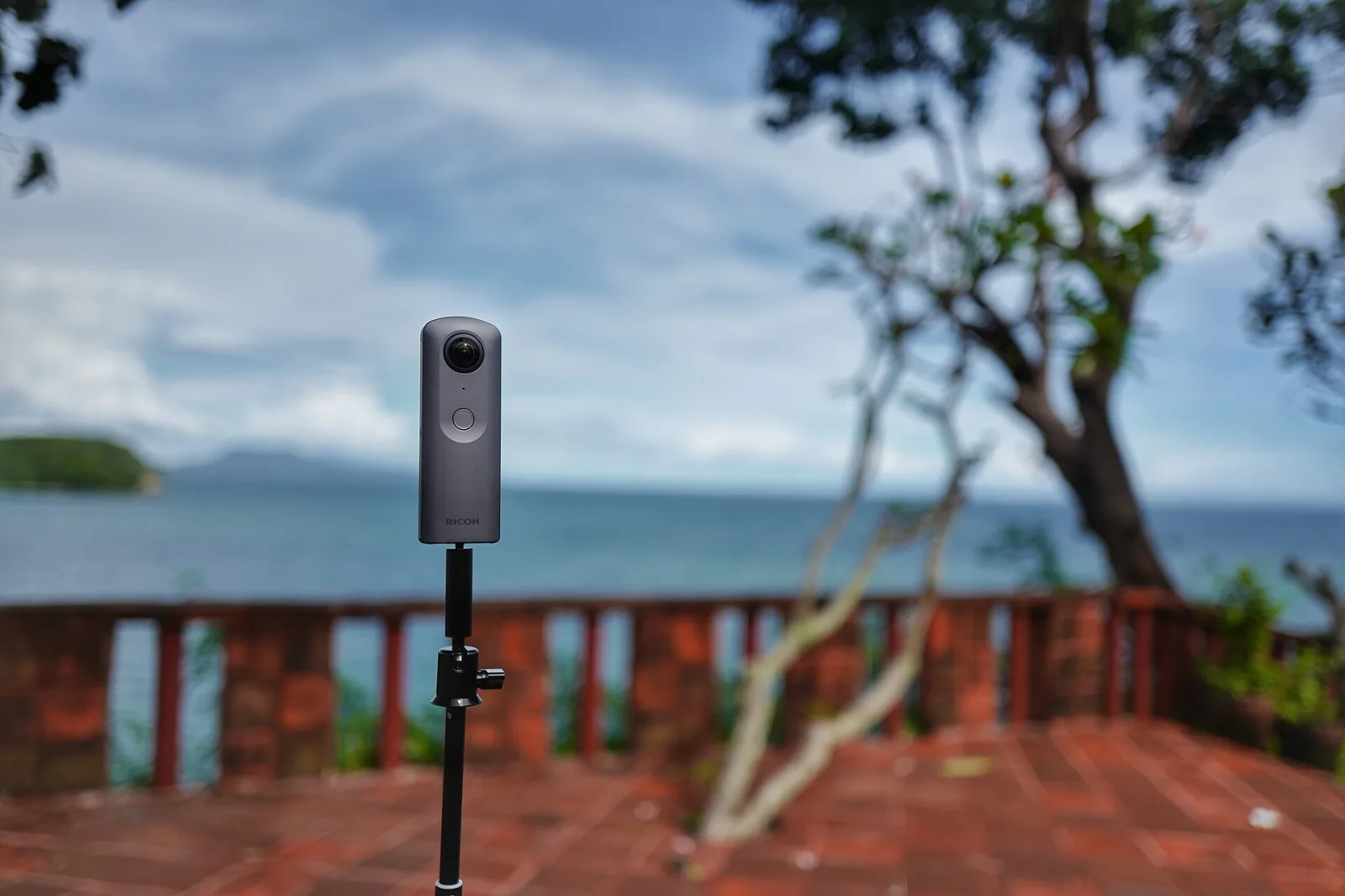
A 360 camera on a thin pole: the lenses on both sides see the whole sphere, and the pole keeps the operator out of the frame as much as possible.
Image: 之乎, CC BY-SA 4.0, via Wikimedia Commons (resized, converted to WebP).The software has caught up. COLMAP 4.1, in June, handles 360 images natively; a LichtFeld Studio plugin reads Insta360 and DJI files directly, picks the sharpest frames and masks the operator automatically; Scaniverse accepts 360 clips of up to ten minutes. Insta360 now offers splats straight from the X6, through a cloud service run by a third-party company in China — a point to check under the GDPR before sending a client’s premises there.
What the 360 camera does not give is scale, and its images are softer than a camera’s: it is the tool for speed, not for measurement.
Niantic Spatial’s tutorial on capturing with a 360 camera for Scaniverse: how to move, how fast, and how to hold the camera.
Video: Niantic Spatial, on YouTube.The handheld LiDAR scanner: measured, not estimated
A handheld LiDAR scanner combines a laser that measures distances, several cameras and an inertial unit. As you walk, it computes its own position — the technique is called SLAM — and records at the same time a point cloud at true scale and the images the splat is trained on. There is no position to guess afterwards, which is why it works where photogrammetry fails: corridors, bare walls, dim rooms.
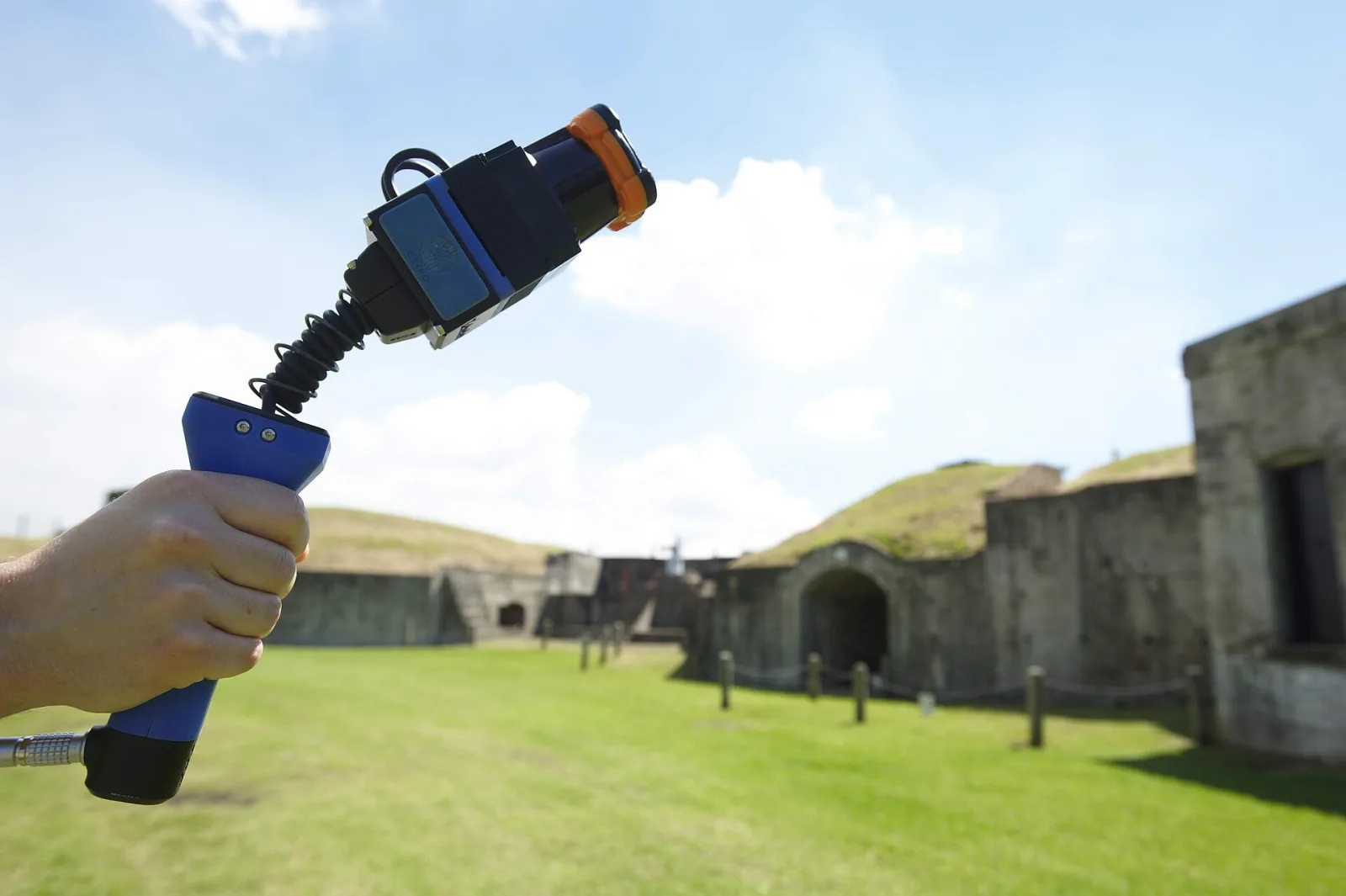
Zebedee, one of the first handheld SLAM LiDAR scanners, developed by the Australian research agency CSIRO: the sensor swings on its spring to sweep the space as the operator walks. Today’s scanners add cameras for colour.
Image: CSIRO, CC BY 3.0, via Wikimedia Commons (resized, converted to WebP).XGRIDS dominates the segment for splats. Its PortalCam ($4,999, 870 g, four cameras) is designed as a spatial camera for splats; its Lixel K1 and L2 Pro are survey instruments; and the Lixel L3, unveiled on 15 September at INTERGEO, produces a point cloud, a mesh and a splat in a single pass, with 5 mm of relative accuracy announced and about 100 m² covered in ten minutes. No official price has been published; a British reseller lists it from £25,199 including VAT. NavVis added splats to its IVION software in August, in beta for its MLX scanner; we found no native splat output for Leica’s BLK2GO, FARO’s Orbis or Emesent’s Hovermap.
XGRIDS presenting the Lixel L3 at its launch in September 2026: one walk, a point cloud, a mesh and a Gaussian splat.
Video: XGRIDS, on YouTube.The drone: roofs, façades and sites
For a building’s exterior or a site, only a drone sees the roofs and the upper floors. Mapping software flies it on an automatic plan: parallel passes looking down, then orbits around the building with the camera tilted. DJI Terra turns the photos into a splat since version 5.0, in its higher editions; Varjo Teleport’s Autopilot, since May, plans the flight from an area drawn on a map and processes everything in the cloud — its demonstration used a DJI Mini 5 Pro (€799). For true scale, a drone with RTK positioning, such as the Matrice 4E, puts each photo in its place to within a few centimetres.
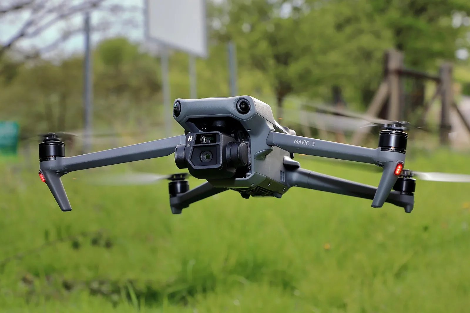
A camera drone of the Mavic 3 family: a large sensor, a mechanical shutter on the enterprise versions, and the software to fly a mapping mission on its own.
Image: C.Stadler/Bwag, CC BY-SA 4.0, via Wikimedia Commons (resized, converted to WebP).The rules matter as much as the hardware. In France, anyone flying a drone with a camera must register as an operator on AlphaTango, the flight ceiling is 120 metres, and the official guidance is unambiguous: “flying in public space in a built-up area is prohibited” in the open category. Capturing a building in town therefore means the specific category — a standard scenario declared in advance or an authorisation — or a specialised operator.
Choosing
Which tool for your project?
- WorkablePhone and app Fine for a small room, walking slowly; the result depends on patience more than on the phone.
- WorkableCamera (and turntable) Excellent images, but hundreds of photos to take by hand in a room.
- Best choice360 camera The fastest way to cover a room: every frame sees in every direction, from €550 to €850.
- Best choiceHandheld LiDAR scanner Fast and reliable: one walk gives the splat and a point cloud, at true scale.
- Poor fitDrone Not relevant indoors or for an object.
Three questions — what you are capturing, whether you need true scale, your budget — and the five families of capture tools rated best choice, workable or poor fit, each with the reason.
The rules behind these verdicts follow the prices and specifications in this article. They answer the most common case; a real project also depends on access, weather and deadlines — and often combines two tools: a drone for the roofs, a scanner or a 360 camera for the rest.
The five families side by side
| Family | Price (Sept. 2026) | Weight | True scale | What comes out | Best for |
|---|---|---|---|---|---|
| Phone and appiPhone 18 Pro · Scaniverse, Polycam, KIRI, LCC Scan | The phone, plus €0–50 a month | ≈ 0.2 kg | Approximate (LiDAR on Pro iPhones) | A splat on the phone or in the cloud | Objects, small rooms, first tries |
| Camera (and turntable)Mirrorless camera, 24–70 mm lens, turntable | A few thousand euros (estimate) | 2–10 kg with the kit (estimate) | With a scale bar or markers | RAW photos, trained on a computer | Products and objects at the highest quality |
| 360 cameraInsta360 X6, DJI Osmo 360 II | €589–849 | 183–195 g | No | 360 video, processed in the cloud or with COLMAP | Rooms and interiors, fast |
| Handheld LiDAR scannerXGRIDS PortalCam, Lixel K1, L2 Pro, L3 | $4,999 to about £36,000 | 0.87–3 kg | Yes: 5 mm to 1.2 cm relative (manufacturers) | Point cloud and images, then a splat in LCC Studio | Buildings, heritage, digital twins |
| DroneDJI Mini 5 Pro, Matrice 4E | €799 to about €4,600, plus software | 0.25–1.2 kg | With RTK or ground control points | Aerial photos, processed in DJI Terra or Teleport | Exteriors, roofs, sites |
Official prices where the manufacturer publishes them; reseller or press prices otherwise (see the sources at the end). Camera kit prices and weights are estimates.
A table comparing phones, cameras, 360 cameras, handheld LiDAR scanners and drones for Gaussian splatting capture: price, weight, true scale, what comes out, and what each is best at.
The same five families, figure by figure. Prices move fast in this market: the 360 cameras and the Lixel L3 were all launched in the last two months.
The accessories that make a difference
- Scale markers. Printed targets such as AprilTags, placed in the scene and measured, give true scale to a capture that has none — and help align several captures together.
- Light. An overcast sky outdoors; indoors, soft lights that do not move. Cross-polarisation — a polarising filter on the light and another on the lens — removes reflections from glossy objects, at the cost of some of the realism a splat can reproduce.
- Scanning spray. On transparent or mirror-like surfaces, a spray that disappears after an hour or two gives the software something to hold on to; it flattens colour, so it suits geometry more than colour-accurate splats.
- Batteries. From 36 minutes of flight for a Mini 5 Pro to about 100 minutes of scanning for a Lixel L3: plan the capture around them.
At ARGO
We choose the tool according to what the experience must show and prove: a phone or a camera for a product that will be seen up close, a 360 camera for a shop or a showroom captured in a few minutes before opening, a scanner when a place must be measured, a drone for the outside of a site. And in every case, the goal is the same: a splat light enough to open in a phone’s browser, from a QR code, without an app.
FAQ
Frequently asked questions
Sources and further reading
- Capture guides: PlayCanvas, Taking photos for Gaussian splatting · Radiance Fields, How to capture radiance fields
- Phones and apps: Apple, iPhone 18 Pro specifications · Niantic Spatial, Scaniverse FAQ and 360 camera guide · Polycam pricing · KIRI Engine pricing · Varjo Teleport pricing
- 360: Insta360 X6 (Phototrend) · COLMAP 4.1 · LichtFeld 360 plugin · Insta360 Spatial Capture
- LiDAR: XGRIDS Lixel L3 press release · XGRIDS PortalCam · Heliguy, Lixel L3 vs L2 Pro (reseller prices) · NavVis IVION changelog
- Drones: DJI Matrice 4 specifications · Heliguy, DJI Terra and Gaussian splatting · Varjo Teleport Autopilot · EASA, Open category · French Ministry for Ecological Transition, open category and specific category
Prices, products and rules checked on 30 September 2026. Where no official price exists, the source is a reseller or the press, as stated.